Building the Route: From the Bottom of Texas to the Top
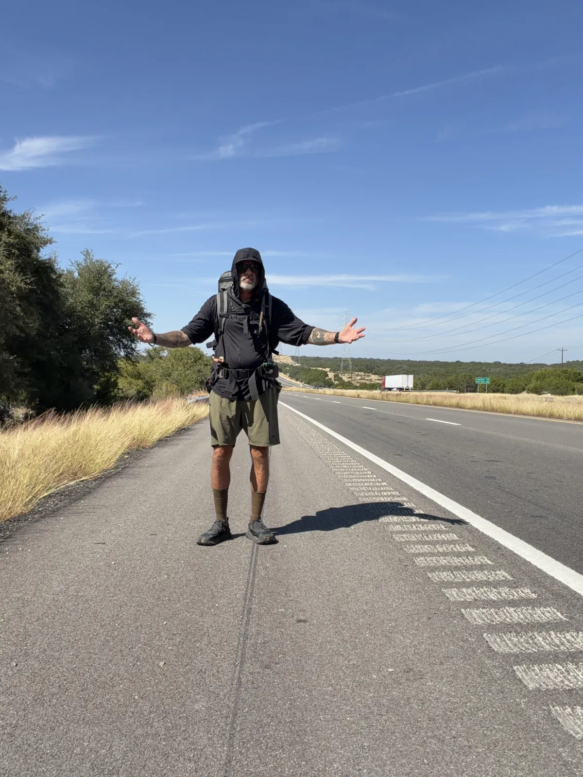
When I say I am rucking from the bottom of Texas to the top, I mean it in two ways.

The line on the map starts at sea level in Port Arthur and climbs to the highest point in the state, Guadalupe Peak, before finishing at Mount Cristo Rey in El Paso. The other line is the one I have walked in life, from rock bottom addict to a man building the life of his dreams. The route mirrors that redemption arc. Water to stone. Chaos to clarity. Gulf mud to mountain air.
I am an eighth-generation Texan, so this place is in my bones. Texas is not one thing. It is coast and bayou, piney woods and prairies, limestone hills, high desert, and real mountains. Each landscape teaches something different and each one hits the body in a different way. The coast brings heat, humidity, and mosquitoes that test patience. The piney woods add shade but hold the heat, so breathing feels heavy and slow. The prairies are wide open, sun on your neck all day, wind in your face. The Hill Country rises and falls, narrow shoulders, blind curves, and a mix of limestone dust and clear creeks that can lift the spirit and chew up the legs in the same hour.

West Texas is distance and quiet, long gaps between water, mirage shimmer, and headwinds that make you earn every mile.The Guadalupe Mountains aren’t the end of the journey, but they mark the high point-literally and spiritually. Climbing Guadalupe Peak, the highest point in Texas, will be a moment to look back on everything I’ve crossed to get there: the coast, the woods, the plains, and the hills. But it won’t be the finish. From there, the route drops west toward El Paso and the final climb up Mount Cristo Rey. By the time I stand at that summit, I’ll have carried a piece of every Texas landscape with me-and every lesson they’ve taught.
Part of the route goes through my home ground in the Hill Country. That matters. It lets me bring in my people, the community that has formed around the endurance events we host with Official Project Grit. With GoRuck We will host 6 community rucks in a few towns along the way, not to make the miles easier, but to share the fire. People step into the weight and remember they are built for more. That is why we do this.
How I build the line
Start with the spine. I lay down the big waypoints first, Port Arthur to Van Horn, then north to Guadalupe Peak, then west to Mount Cristo Rey. That gives me a backbone.A lot of this route runs along major highways and interstates. It’s not the most scenic or peaceful way to cross Texas, but it’s the most practical. Being self-supported means I have to think in terms of supplies, not sightseeing. The highways give me access to what I need-gas stations, restaurants, laundromats, and the occasional motel when I’m lucky. It’s not ideal, but out here, practicality beats comfort every time.
Break it into days. The target is twenty-five miles per day. I try to end near a potential cowboy camping spot, a park, a church with a pavilion, a windbreak, or any place that allows me to get a quiet rest. If a day runs hot or elevation stacks up, I shorten it. If a day is cool and flat, I may stretch it.
Mark resupply and cache segments. Every day gets a food and water plan. I log towns, gas stations, and stores but out west its almost all supply caches. I pre-built and stashed my DIY PVC food tubes, loaded with freeze-dried meals, water, and propane for the Jetboil. Each cache is calculated to the stretch: calories needed, liters of water, number of boils, and a small buffer for bad luck. I name every cache with a simple code, for example, D12-Cache-B, then drop the exact coordinates and a short description of the hide so I can find it when I am tired.
Sync and verify. Building a route this big took hours of calls with Garmin support to get it dialed in. They don’t typically work with 1,000-mile, 40-day routes. We had to troubleshoot everything-how to segment it, how to sync it, how to make it work reliably.
I carry a Garmin inReach for the stretches without reception and as a lifeline in case of emergency. A close friend-a former Special Forces operator who knows routes and navigation-can track my location at all times, just in case. And I keep redundancy built in: paper notes, phone backups, and screenshots. Because out here, things don’t always work the way they’re supposed to. Preparation isn’t optional.
Scout and plant. I pre-drove the long gaps to place caches. The PVC tubes get stickers that explain what they are and list my contact information so nobody mistakes them for something they are not. I spray paint the tubes to blend into the area, then take photos and angles so I can recover them quickly. Hides are chosen so I can reach them on foot, retrieve, and leave no trace.
Why this detail matters
Self support means the plan must carry me when my mind gets loud. When Im worn down I do not want to make big decisions from a place of fatigue. I want the route to speak for me. Turn left at the farm road, cross at the bridge, camp behind the church pavilion, boil water, eat, sleep, wake, repeat. A thousand miles is less about heroics and more about stacking good choices for forty days.

The line on the map is also a teacher. The coast teaches humility. The prairies teach patience. The Hill Country teaches attention because a missed step can hurt you. West Texas teaches resolve because it does not care about your feelings. The mountains at the end teach gratitude. You look back and know every mile cost you something, and the price was worth it.
I built a route that is honest. It respects the land and the people who live along it. It allows me to carry what I need, cache what I cannot, and meet my community where we have always met, on the road under weight, moving forward together.
From the bottom to the top, from the lowest point in my life to the highest places I have known, this is the path.